


Smoke from the Cedar Creek Fire flows into Bend, Oregon on August 3, 2022.
It’s August on the West Coast and that means Wildfire Season is upon us. Unfortunately, it’s the reality for many of us (as I type this, I can smell a wildfire and am watching as my air quality index (AQI) climbs over 150).
Over the past few years, information about fires has become more readily available. There are Twitter feeds churning out helpful information, and generally, when large fires pop up someone puts together an online map for the public.
The problem has been those small fires that still produce smoke that can impact cities and towns. Viewing these incidents on a single map has been difficult.
The newly launched FireMap brings spatial context to the table by displaying all wildfires in the Western United States on a single map. Our team developed this intuitive and easy-to-use web app for the Western Fire Chiefs Association using a blend of technologies and data sources. It integrates data from multiple, authoritative datasources, taking the best information from each and presenting them in a blended manner to produce a best-in-class representation of what's going on with wildfires across the west.
Users can search for a fire by name. Additionally, they can zoom to a location or zoom to their location and explore the area nearby. Larger fires that get mapped will display the perimeter as changes are reported. Along with the map visualization, the app provides details including fire size in acres, 24-hour growth, percent containment, number of personnel assigned, how long the fire has been active, and when the information was last updated.
Clicking the Share button allows users to easily share information about a fire. Below we used the “embed” option to link to a live map of the McKinney Fire. Click the fire symbol on the map to view information about the fire, and to share to social media. Other features, such as weather and wind information, is in the pipeline. Bookmark the site now to keep it in your back pocket as we go through this Wildfire Season.
No one welcomes Wildfire Season, but now at least we have another tool to help us be informed and prepared.
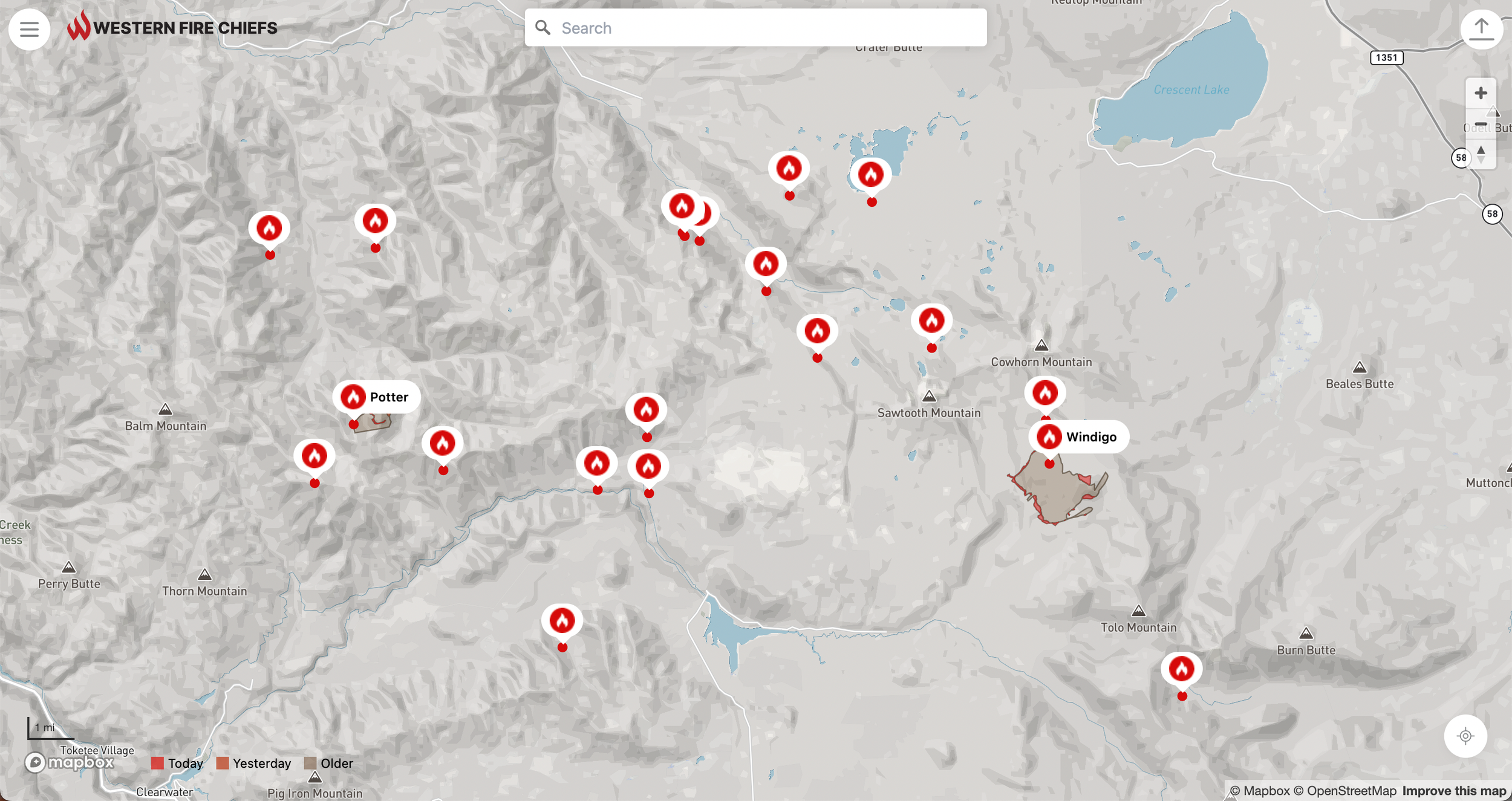
A lightning storm this past weekend started a lot of fires. All of the known starts are visible on the map.

Clicking symbol on the map highlights the fire on the map and brings up the relevant data.
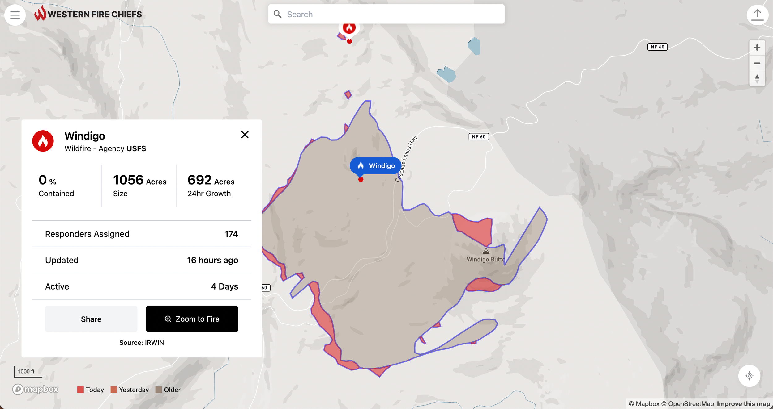
Clicking the Zoom to Fire button causes the map to zoom into the fire’s extent. Daily perimeters are displayed.